Neighbourhood Plan - Latest News
The "Made" Neighbourhood Plan is available online on Buckinghamshire Council website or by apppointment may be viewed at the Parish Council office.
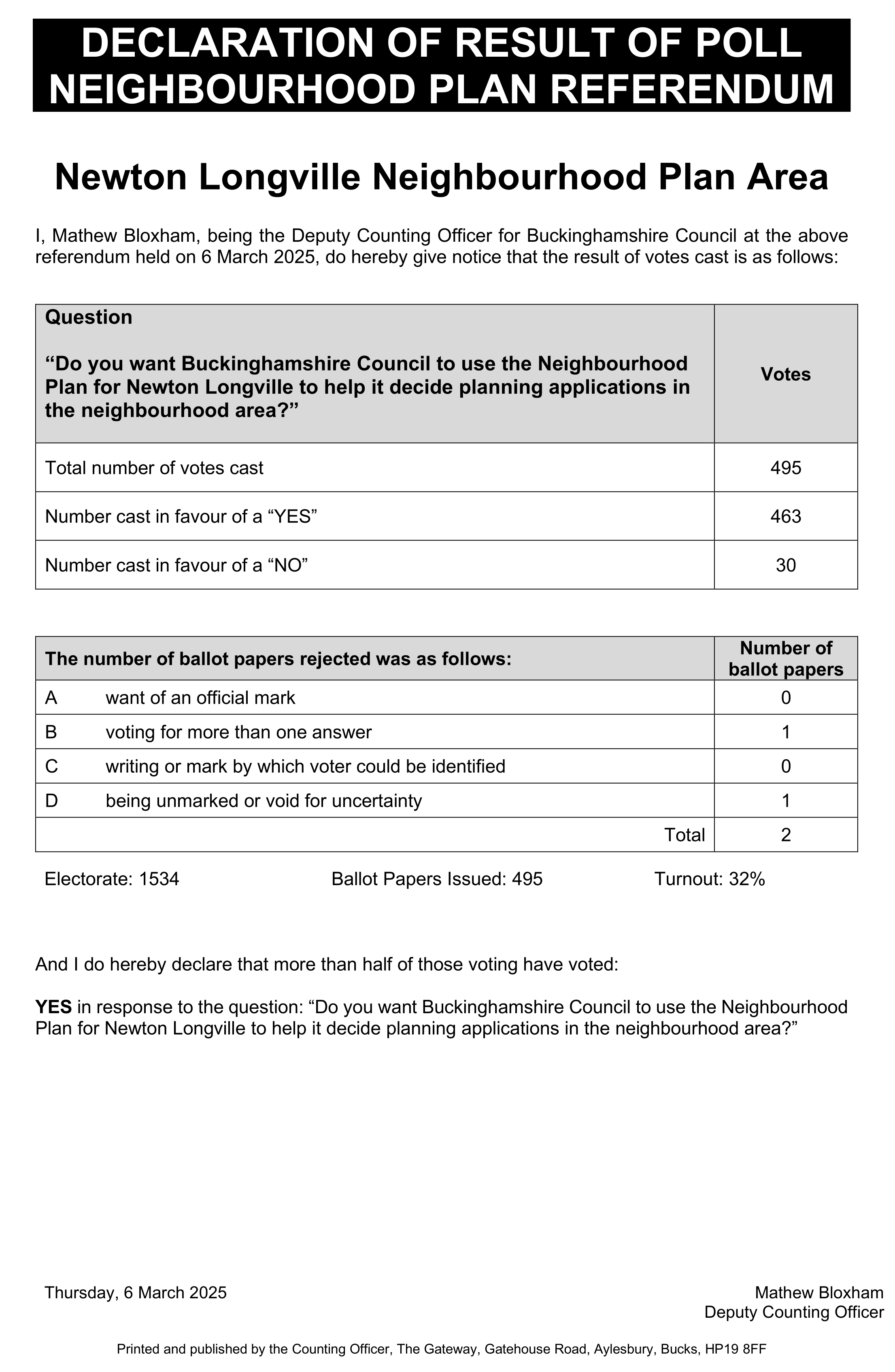
A big thank you to everyone who has turned out today to participate in the Neighbourhood Plan referendum.
In total, 495 votes were cast (32% of the 1,534 electorate). To the question: “Do you want Buckinghamshire Council to use the Neighbourhood Plan for Newton Longville to help it decide planning applications in the neighbourhood area”:
463 (93.5%) voted YES
30 (6.1%) voted NO
2 (0.4%) of the ballot papers were blank/spoiled
Therefore as of 7th March the Neighbourhood Plan is part of the Development Plan for Buckinghamshire.
The official notification for this from Buckinghamshire Council is below.